Friday, September 30, 2011

TRIM


I feel like we've driven for hours, but we're still too early to check into our B&B in Trim. So, since we're obviously in Ireland, we'll do as the Irish might, and pop into the nearby pub to order a half pint and enjoy a little conversation. We're pretty sure we'll be entertained or enlightened with what we find, but this was a real surprise.  

As you can tell, this was not a fancy pub. In fact, it was a little dingy, and I was surprised BC chose it. We parked our car across from "The Steps", walked in and found a barman on duty with three locals sitting at the bar. Two sat to the left of the barman, and the other, a younger fellow, was near the end of the bar on the right. We left a few seats open in both directions, but sat down toward the left side. All four men were chatting--they obviously knew each other well. I ordered my Stella Artois while BC had a Guiness. We were obviously strangers to Trim and "The Steps" and, for them, it was simply another day and another curious tourist. Initially, they talked more around us than to us.

After ten minutes or so of neutral chit-chat, the gray and grizzled gentleman to my left moved over to sit right next to me. It's pretty obvious he'd been there most of the day so his words were not only a bit slurred and sloppy, but  he also spoke with a thick brogue accented by melodic ups and downs in tone. He sidled in very close and began a conversation that I could not understand at all. Of course, I'm trying to be my usual  nice/sweet self so I'm being polite by saying "uh huh" every time he paused, and then I would smile. He is talking and talking and I'm listening and listening and finally I begin to make a bit of sense out of what he is saying. 

He is talking about the movie "Braveheart," which was partially filmed here in Trim. Specifically, at the Castle, where the Trim Castle Gate was in play. He was involved (I think) in part of the filming...something about opening the fookin Castle Gate so that  fookin Mel Gibson could do whatever he was fookin supposed to do. Mel must have had an off day, because the gentleman who is ooching ever closer to my left while I precariously lean more and more to my right, actually had to open the fookin Castle Gate fifteen times for the fookin filming. And, after all of that, his paycheck was only a fookin fifteen hundred pounds. I think. Actually, I thought that fifteen hundred pounds was pretty good pay, but apparently it was not fookin enough. And the gentleman was still ticked off. At one point, the barman did interrupt when the fookin guy on my left, apparently really let go with the language (which I couldn't understand anyway) and he was quiet for a few seconds.

That gave me a chance to look at my watch and see that it was nearly Opening Time at our B&B. We guzzled what was left of our beer, told everyone good-bye, and ran for the door. We laughed all the way to our lodging--only getting lost and confused a few times, and considered this one of our best afternoons yet. 


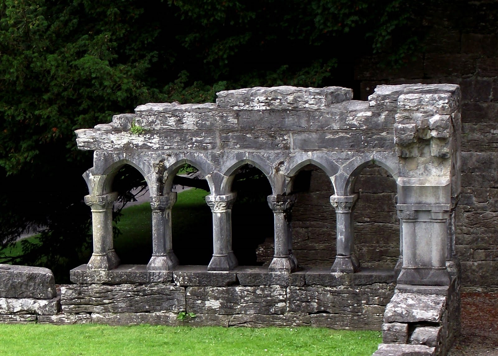
Trim Castle, as so many others, began construction in the 1100's, continuing off and on for the next three hundred years or so.  It was a unique design for its time, containing a three-story keep that was built in a cruciform shape with twenty corners.  As with all great plans of mice and men, it's unique style didn't keep all attacks at bay, but its worst enemy has been time.


Inside the keep, this wall shows where floor joists would have been placed to create a higher story.  The castle itself was purposely built  to be something of a maze in order to protect its occupants.  We watched Braveheart after we returned home, but didn't recognize much about the castle except the stone walls.  The gate scene, that played such a large part in our previous afternoon was so dark I missed  that it was the fookin Trim Castle. 


Our view from the top of the castle looking toward the town of Trim.  The River Boyne is in the foreground, and remains of the castle are directly beside it.  Back in the day, ships could sail from the Irish Sea up the river to the castle's front door.


This was one of Ireland's beautiful days.  The sun is always welcome but, also always prone to pop in and out.


Trim was a pretty little town with its share of notables.  Jonathan Swift of Gulliver's Travels fame lived here when he was a Vicar in the Church of Ireland.  It's only about 45 minutes from Dublin, which makes it a popular stop for first or last nights in Ireland. We loved it. 

Wednesday, September 28, 2011

COUNTIES MAYO AND CONNEMARA

Today, we'll journey from Westport to Galway, choosing the longest route possible at every crossroads.  Our days are running short and we're due in Trim tomorrow.  This is our semi-farewell to Ireland and we don't want to miss a thing.


A few miles outside of Westport, we stopped to visit the National Famine Memorial.  This bronze sculpture is of an 1840's Coffin Ship similar to that we visited in Dunbrody.    However, skeletons swirl around this ship, reminding us of the Irish peasants who died at sea on their way to the New World.  This is a solemn visit, and there are more to come before nightfall..


Directly across the road from the Famine Memorial is Croagh Patrick, a 2500 foot mountain upon which St. Patrick may have fasted for forty days one early Lent.  I'm most pleased that he also rang a bell from this mountain and banished all the snakes from Ireland.  Ever since our Sun City Grand neighbor discovered a rattlesnake on the spit of ground between our homes, I've been obsessed and done most of my neighborhood walking with eyes down watching the areas around my feet.  Ireland, by contrast, was totally relaxing...we walked through tall grass, piles of leaves and deep dark woods with no worries at all.


Excuse me, ladies--you're on the wrong side of the road and I think you may be "moo-ing" at the wrong gate.
 

This is NOT the Ireland the travel brochures highlight. This is the Ireland in which crops failed and starvation was real and the English Lords looked the other way. I so love England as well as Ireland...but not right this minute. We're in the Doo Lough Valley--or Black Lake Valley. We look around and this is exactly what we see. Everywhere. No homes, no farm buildings, no fences, no brilliant shades of green.   There is, however a slight touch of wind and the soft keening echoes of sorrow and death. We stop the car and walk our separate ways. It's a place to be alone and quiet and prayerful. 


As we approached Black Lake we stopped to read this sign--part of a larger memorial topped by a rough cross.  It reads:  "To commemorate the hungry poor who walked here in 1849 and walk the Third World today...Freedom for South Africa 1994...'How can men feel themselves honoured by the humiliation of their fellow beings'" Mahatma Ghandi in South Africa.  A similar plaque on the same memorial noted Archbishop Desmond Tutu's participation in a commemorative walk in 1991 along this famine trail.


We've reached the Black Lake. The farmers of County Mayo were completely dependent on  potatoes for their food.  We heard numerous stories of the Irish, boiling one potato per meal for each family member, then placing those boiled potatoes on the table. That was the extent of their nourishment--simple, plain boiled potatoes.  Obviously, the Potato Famine hit them particularly hard.  Because the English were known to have food in their personal storehouses, a group of 600 starving Irish families walked twelve miles from the town of Louisburgh  to the estate of their landlord--Delphi Lodge--hoping he would take pity on them and give them food.  He did not.  Nearly 200 of them died on the walk back to their homes.  They would have walked exactly where we are wandering this afternoon. 


As BC walked along the lake, dreaming fisherman dreams...


...I explored this little oasis  across the road.  The trees and dark grass were out of place in this area, and I was sure it was the entry to an abandoned estate--perhaps even, Delphi Lodge.  I followed a rocky lane into the property, but found nothing but an abandoned currach and a large storage building.  As I re-crossed the highway and met BC near the shore he stopped short and asked, "Listen--can you hear that?"  I hadn't heard anything.  Again, "There--did you hear that?"  We both stood still and concentrated.  Finally, very faintly...a distant bird call?  Perhaps a light wind blowing through the trees?  It was a very weak cry or a plaintive wail...just for a moment...and then another.  We thought of the starving families stumbling by exactly where we stood.  The despair pouring from their hearts must have permeated all that was around them.  Yes...I believe the spirits might have remained, just so we who listened would always remember.


A few miles later, we arrived in bog country from whence comes the infamous and ubiquitous peat.  We began walking toward these two fellows to learn about bogs until, as our shoes filled with water, we realized that traipsing through a bog is not an easy stroll.  The land "gives" slightly with each step.  We had read that if you jump up and down in the bog, someone thirty feet away can feel it.  So...BC jumped and, yes, I could feel the vibration.  But, more disorienting--because it is so completely wrong--I could see the ground move up and down under his feet.  For lack of a better word, it was spooky, but kind of fun.  Then we saw that jumping could make the fence posts and wire sway.  Wow!  There is nothing like two old people  jumping in the bog. Apparently, the Irish men working that day were used to it. Crazy Americans!   


The peat is cut very neatly (special shovels) from the bog and then laid out to dry.  We did see peat in most of the B&B's where we stayed.  Unfortunately, no one was burning it and so we never smelled it.  Supposedly, you'll never forget it and, if you're Irish, it will always smell like home.  We do have a small piece we brought back.  We'll light it one of these days and see if we can sense the magic.


Again, as with so much in Ireland, we have experienced the sublime as well as the ridiculous...all in one afternoon. Obviously, I would have liked to have been "to the manor" born, so I am enjoying and pretend-decorating the lovely Kylemore Abbey  It was built by a wealthy Englishman, Mitchell Henry, sometime after he and his wife (her name was Margaret) visited this area on their honeymoon.  Years later, it became an exclusive girls' boarding school, even later it was a convent and, since 1920, the Benedictines have owned it.  Today, it attracts hordes of tourists. Our guide-book (the cynical one--we always travel with at least two) said the best thing about Kylemore Abbey was the view of it from across the lake, so we took that literally, bought an ice-cream cone, sat back and admired.

The afternoon flew by and we continued the journey toward Galway, planning to find an attractive B&B on the way.  However, we had forgotten the value of pre-planning our stays, and realized the only time B&B's appear on every corner is when you're not looking for one.  Near dusk I was just a bit nervous, and trying to stay calm by remembering our first B&B hostess who claimed, "You can always find a B&B somewhere...it's not a problem."  And--after what seemed a very long search, we did!  We found a guesthouse a mile or so down a very narrow lane just beyond the village of Maycullen on the outskirts of Galway, complete with two Beagles and a super hostess. The next morning we stayed much later than planned,  chatting with her. It's fun to meet people who, within minutes seem to be an old friend. That is Ireland and that was Bernie.

Monday, September 26, 2011

KINVARA TO CONG TO WESTPORT

While lifting a glass in Mom's honor at Crowley's pub a few evenings back, we struck up a conversation with a young salesman who lived in Galway.  In the course of the evening (remember, everyone buys a pint for everyone else) he recommended we visit Cong, one of his favorite places not too far from Galway.  Like nearly all obedient travelers, we checked with Rick Steves who had included Cong in a road trip through County Mayo and Connemara, so we highlighted our map and settled our plans for the next day.


The drive from Kinvarra to Cong was beautiful and we made multiple stops to photograph the stone fences, the cattle, the sheep and crops.  BC couldn't get enough of these fences, pulling over time after time with instructions of "Now there's a picture." "Now you should take a picture of that!"  What did Ireland look like long ago before every field was divided by stone fence after stone fence? I don't know, but  those hardy souls who chose to work this land must have been both optimistic and incredibly strong.   


When we arrived in Cong which is built on an isthmus between two lakes, we stopped first at the remains of Cong Abbey which, reportedly, housed the last High King of Ireland for the final few years of his life.  I think he may have been hiding out with the monks after he realized the Normans were just too much for him. There isn't much left of the cloister, but what is there is lovely.


We followed a narrow path leading from the cloisters onto a bridge that crossed an old canal before continuing on to the the River Cong.  The canal path was busy with families fishing, little boys showing off on their bikes, and moms pushing the latest family additions in over-sized strollers.  BC stopped to talk to every fisher-person he saw.  They definitely speak a common language.  I had fun watching a little five-year-old handle a fishing rod like he'd done it for years...and, most likely, he had!


We continued on to the River Cong where, hundreds of years ago, the monks from the Abbey built an elaborate stone  fishing hut near the shore in such a way that the river ran under it.  They stayed cozy near the fireplace they had built into the hut, opened the trap door in the floor, and netted their catch.  Supposedly, they had attached a bell  between the hut and the abbey kitchen so the cooking monks would know the fishing monks had been successful, and they would be grilling fish that night.  BC thought the fishing monks had the perfect vocation.


We crossed the river and followed this lovely wooded trail to Ashford Castle--now an exclusive hotel.  The only guards at today's castle are two well-dressed doormen who keep the riff-raff out.  Tourists can wander the grounds...as long as they don't get too close. 


The Mama swan seems to be a bit shy, but the youngsters are quite friendly.


If you have an excellent memory and are a John Wayne fan, you may recognize this as the pub in "The Quiet Man." The movie was filmed in 1951 and I remember going to see it with my Mom who, obviously, loved everything Irish. I thought it was very dull and, even though it was a movie, I couldn't even work up excitement. 

Sixty years later, BC and I walked in for a little sit-down and a half-pint, joining a group near the bar. Small children and babies were everywhere. Eventually, we noticed that the room we were in was fairly crowded but no one was in the opposite end. I finally realized that the other end must have been sacred ground and, apparently, no one entered that space.  It was a "The Quiet Man" homage. Apparently. We're not sure, but we stayed carefully away.


See, it was an homage.

We managed to take a wrong turn leaving Cong (I know, it's redundant) and eventually realized we were driving in exactly the opposite direction we had intended.  It was a beautiful drive, but after close examination of the map we realized there was no way to get to Westport from here, so we turned back to Cong and tried again.


Welcome to the Boulevard B&B in Westport.  The first thing BC said to me when we walked in was, "This is the house you've always wanted," and I had to agree.  And, within a split second, the owner broke in with, "I'll sell it to you!"  What a temptation...what a huge amount of work...what expensive upkeep...what a lot of kitchen time cooking early breakfasts...what a lot of beds to make and bathrooms to clean, but...


What a great view from our room. It'll do...

Friday, September 23, 2011

THE CLIFFS OF MOHER AND THE BURREN


Good Morning! This is Bessie who, with  her friends joined us for breakfast  just outside our window.  Bessie is standing in rich thick grass, but the flowers (or what's left of them) on our side of the fence are just too good to pass up.  Bessie has learned the value of eating dessert first.

We're leaving this morning as we've planned to end our day very close to Galway, and it's a bit of a hike.  We've just succumbed to our hostess' suggestion that we leave by way of Conor Pass--a "beautiful" drive that will add only a "little" bit of time to our trip.  Considering our "age and stage," we don't want to miss any more beautiful drives than we absolutely have to, so we're penciling in Conor Pass and working with our GPS.


Yes, as far as we know this may well be Conor Pass but we're really not sure. We've come from bluish skies into a land filled with clouds--more clouds with every few feet of elevation.  Surely we're getting close.  We found a pullout and joined a number of other cars and disappointed photographers taking pictures of the low clouds, the fog and the drizzle.  If it wasn't for "Picasa's Photo App" and it's computerized magic, this photo would be nothing but a dark grey blob.  Oh well--it was only a little out of our way.

We took a shortcut to the Cliffs of Moher which meant crossing the River Shannon on a ferry.  I'm always amazed at how many cars, trucks and trailers can fit on a ferry without sinking it.  We walked to the top of the boat for the view and as I looked down I saw this great car.  Can't you just see Hercule Poirot or Lady Grantham from Downton Abbey  comfortably settled in the back seat?  There's a similar car parked next to it, but it's not nearly as spiffy or shiny It must be for the servants.


We crossed into County Clare and drove toward the coastline on our way to the Cliffs.  As we approached them--buses to the left, cars to the right--we realized this is an extremely popular site. And, an exercise in patience whilst looking for a parking spot. Despite the fact that our car was a sub-compact, it was still too large for any available empty spot.  As we finally semi-parked and crawled out, we were surrounded by parents with babies in strollers, heartbroken toddlers wailing over dropped ice cream cones, and sullen teenagers frustrated with the lack of phone service. Most of them loudly proclaiming  that they would rather be in hell than the Cliffs of Moher.   You know, the normal family holiday scene we look forward to all year.


Despite the crowds and the distant haze, the Cliffs are so worth visiting.  They're obviously dramatic--especially if you can elbow someone out of your way and take in their length and breadth. 


Being a Kansas girl, I'm impressed again at the force of the sea and the sculptures those waves create.


We're still at the Cliffs simply gazing farther into the distance. We'll try to find our little wrinkled Nissan now, point ourselves toward the northeast and drive to the Burren.


And here we are. According to the guidebooks, the Burren is about ten square miles of limestone--a former seabed, so alert visitors will find evidence of fossils in the stones.  As we walked from the parking lot toward "Poulnabrone Dolmen," the stones gradually increased from being scattered here and there to this scene (below) where they nearly pave the landscape...


forming a rough road of sorts.


This is the "Poulnabrone Dolmen" and, no, I can't pronounce it, but I was terribly impressed. Wikipedia wrote that it translates to "hole of sorrows."  This is a portal tomb (who knew?), a grave chamber that was once in a cairn of stacked stones.  In more recent years, the Irish have called it a druids' altar.  I don't normally think in symbols or biblical images, but the thought of Easter Morning and sunshine and open tombs popped right into my mind.


I'm not a botanist, nor even a gardener, but I am fascinated when delicate little flowers bloom in such a forbidding landscape.  Our mother earth is much more complex than most of us can understand.


Our day came to a close in Kinvarra at a small B&B overlooking Galway Bay. 

Wednesday, September 21, 2011

THE DINGLE PENINSULA

The Dingle Peninsula (fortunately or unfortunately, depending on your outlook) is most often ignored by the larger tour companies.  Roads are narrow and the terrain can be treacherous--one doesn't just happen onto Dingle, one comes here on purpose.  Dingle's population of 10,000 (down from 40,000 before the Irish Famine of the 1840s) clings tightly to its heritage--most notably in those areas that are Gaelic speaking.  Signage over the entire peninsula is in Gaelic and, trust me, there is nothing phonetic about it.  Dingle hosts many boarding summer schools for "city" kids sent here by parents hoping to keep the olde traditions alive.  It's beautiful, it's desolate, it's wild...it's not to be missed.


It is not, however, blue, despite this photo.  It was, as you'll soon be able to tell, extremely gray, windy, cold, rainy and foggy during most of our day of touring.


We've had to forget the scenic views of various bays and islands as the low clouds are hanging only a few feet above our car.  We do pass numerous ring forts, most of which resemble unrelated piles of stones.  We pass by full of regret, but hope to stay fairly dry this morning.   The wet(ter) area of the road in the photo above is actually the ford of a stream.  I had anticipated a bit more excitement as I read the description in the guidebook.  Apparently, the area receives 100 inches of rain a year, so it's only natural that today might be one with rain.


We did venture out of the relative warmth of our tiny car for a closer look at these beehive huts which may date as far back as the Bronze Age.  They're found primarily in southwestern Ireland and are relatively common in Dingle.  Later huts may date from the Christian era.


This is not a good day to be a seagull.  His feathers are fluffed, but he's still not terribly happy.  "Free as a bird" does have its downside.


This isn't what I'd call a stormy day because the wind is not close to gale force, but the waves are rushing ashore at Slea Head.  We've stopped here for the views of the Blasket Islands (somewhere in the distance), but we leave impressed by the force of the waves and wonder what a real storm might look like.   


Did I mention the roads are narrow?


About 22 kilometers into our journey, we left the main road to visit the Great Blasket Centre and, by sheer happenstance (and a desire to get in out of the rain), walked into one of the most fascinating (and touching) afternoons of our trip.  The Centre was built in the early 1990s to honor and remember those who lived on  Great Blasket Island, just a few miles off the Dingle coast.  The island was inhabited from time immemorial by a hardy people who clung to their own language, political system, culture and lifestyle.  As late as the 20th century, it would have been possible to live a full lifetime without leaving the island.  Over the years, the population dwindled and finally, in 1953, the last of the islanders were brought to the mainland.  The sadness of that day and the years that followed is palpable in the islanders' eyes as they are interviewed in a video.  The Centre museum is detailed, but never boring.  BC and I are museum people, but most others lingered along with us.  The stained glass pictured above is only half of a brilliant window wall at the entry of the Centre.


We think we know exactly how this poor devil feels. But considering the seriousness and the sadness of this place...not really.


About ten miles beyond the Centre, we detoured to see the Gallarus Oratory.  It was built about 700 CE as an early Christian Church.  The stones used to build it (dry-laid, of course) were all slightly slanted to the outside of the building and  fitted perfectly so that rain could not get in.  To this day, it remains dry inside.  The stone work on the inside, filed or chiseled to a fine thickness, is so intricate as to be beautiful.  There is one tiny window opposite the door.  Amazing! 


A close-up of the stones of Gallarus.


We stopped at Kilmalkedar Church (from the 1100's) to wander its large graveyard dating from medieval days to the present.  We stopped particularly to view an ogham stone dating from about the 300's CE that, over the years, served as a place to seal a contract.  A hole had been drilled through the stone and two people touched thumbs through that hole as they stood on holy ground, thus sealing their contract.  We decided to  renew our marriage vows through the ogham stone, but before we could accomplish that (us and about fifteen other people who were doing the same thing) a cranky Dingle farmer on a tractor, who was blocked by our not so careful parking, let us know he was having none of that sentimental "sealing" nonsense.  We left with our heads hung low as he "putt-putted" up the road.   


We finished our tour of the Peninsula and headed back to Dingle Town.  Each to his own, of course, but I really liked Dingle.  It's "forlorn" feel and the terrain--at least for me--created an authenticity not always apparent elsewhere.  Life was hard here and life was real.